Why Hurricane Lee is worrying weather experts even if it doesn’t break land
As Hurricane Lee builds in intensity, here’s why the storm system in the Atlantic is concerning meteorologists even if it follows projections and doesn’t make landfall.
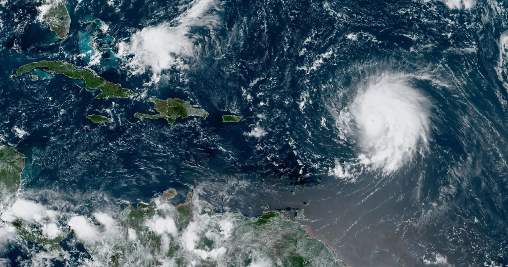
Hurricane Lee, the storm churning through the open Atlantic waters Friday, is expected to pass well north of Puerto Rico and several other Caribbean islands. But even if it doesn’t make landfall, its rapid intensification into Category 5 is enough reason for alarm, according to meteorologists and climate experts.
It is the latest storm to accelerate at a breakneck pace partly because ocean temperatures have been unusually warm, giving hurricanes the energy they need to gain speed and power, according to experts.
“Lee’s rapid intensification to a Category 5 is a harbinger of the future. We should expect more cases of rapid intensification as the climate continues to warm,” said Jeff Masters, a former hurricane scientist with the National Oceanic and Atmospheric Administration, who now works as a meteorologist for Yale Climate Connections.
In the span of roughly 24 hours, Lee intensified from Category 1 to Category 5 — a rare occurrence. The storm was moving at 14 mph Thursday morning, with maximum sustained winds of 80 mph that then increased to a staggering 165 mph by Friday morning.
Lee was about 565 miles east of the northern Leeward Islands in the Caribbean and barreling west-northwest at 13 mph, with sustained winds near 155 mph, the National Hurricane Center said in a bulletin at 11 a.m. ET Friday.
Rating: 5